top of page

Historic Sites List

Accotink Railroad Station (1890-1904) (Site)

Accotink Railroad Station (1890-1904) (Site)

GPS Coordinates: 38.7345644, -77.1838502
Closest Address: 8184 Newington Road, Lorton, VA 22079

Accotink Unitarian Universalist Church

Accotink Unitarian Universalist Church

GPS Coordinates: 38.7742031, -77.2974030
Closest Address: 10125 Lakehaven Court, Burke, VA 22015

Accotink United Methodist Church

Accotink United Methodist Church

GPS Coordinates: 38.7110681, -77.1591372
Closest Address: 9043 Backlick Road, Fort Belvoir, VA 22060

Accotink United Methodist Church Cemetery

Accotink United Methodist Church Cemetery

GPS Coordinates: 38.7115667, -77.1590091
Closest Address: 9041 Backlick Road, Fort Belvoir, VA 22060

Action at Annandale Historical Marker

Action at Annandale (Historical Marker)

GPS Coordinates: 38.8282510, -77.1856680
Closest Address: 7001 Little River Turnpike, Annandale, VA 22003

Advantageous Fencing Historical Marker

Advantageous Fencing (Historical Marker)

GPS Coordinates: 38.7056502, -77.0905523
Closest Address: 3200 George Washington Memorial Parkway, Alexandria, VA 22309

African American Heritage Memorial Historical Marker

African American Heritage Memorial (Historical Marker)

GPS Coordinates: 38.8018977, -77.0598355
Closest Address: 500 Holland Lane, Alexandria, VA 22314

African American Neighborhoods Historical Marker

African American Neighborhoods (Historical Marker)

GPS Coordinates: 38.8109567, -77.0393117
Closest Address: 100 Madison Street, Alexandria, VA 22314

African American Neighborhoods in the Civil War Historical Marker

African American Neighborhoods in the Civil War (Historical Marker)

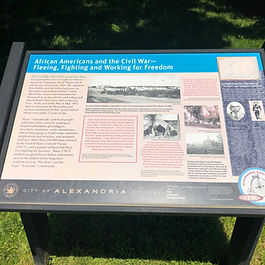
GPS Coordinates: 38.7994550, -77.0424544
Closest Address: 501 South Union Street, Alexandria, VA 22314

African American Waterfront Heritage Trail Historical Marker

African American Waterfront Heritage Trail (Historical Marker)

GPS Coordinates: 38.8055260, -77.0386422
Closest Address: 1 Cameron Street, Alexandria, VA 22314

African Americans and the Civil War Historical Marker

African Americans and the Civil War (Historical Marker)

GPS Coordinates: 38.8289981, -77.1016929
Closest Address: 4301 West Braddock Road, Alexandria, VA 22304

Agudas Achim Congregation

Agudas Achim Congregation

GPS Coordinates: 38.8314711, -77.0803626
Closest Address: 2908 Valley Drive, Alexandria, VA 22302

ABOUT ME

Award-winning local historian and tour guide in Franconia and the greater Alexandria area of Virginia.

  • Facebook
  • X
  • LinkedIn
  • Amazon

ADDRESS

Nathaniel Lee

c/o Franconia Museum

6121 Franconia Road

Alexandria, VA 22310

franconiahistory@gmail.com

SUBSCRIBE FOR EMAILS

Thanks for submitting!

© 2025 by Franconia History L.L.C.

bottom of page