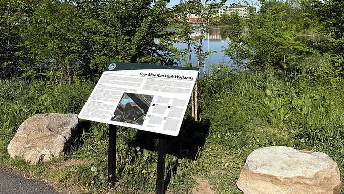
Four Mile Run Park Wetlands (Historical Marker)
GPS Coordinates: 38.8418445, -77.0610029
Closest Address: 3700 Commonwealth Avenue, Alexandria, VA 22305
Here follows the inscription written on this trailside historical marker:
Four Mile Run Park Wetlands
— City of Alexandria, Virginia —
Site History
In response to a history of flooding affecting adjacent communities, the U.S. Army Corps of Engineers partnered with the City of Alexandria and Arlington County during the 1970s and early 1980s to build a flood control channel in the lower portion of Four Mile Run. The flood control channel has safely conveyed the high storm flows through the two jurisdictions. When the Corps conceived the channelization project in the 1960s, the sole objective of the project was flood protection and, in this respect, the project has been a success; no floods have breached the banks along the 2.3-mile channel since its construction. Although successful in flood control, the channelized portion of Four Mile Run left much to be desired in terms of ecology and aesthetics.
With the vision of Four Mile Run becoming a community amenity, the City of Alexandria and Arlington County worked closely with a Joint Task Force of community members to develop the Four Mile Run Restoration Master Plan in 2006. Through the support of Congressman James Moran, Congress appropriated funds for the U.S. Army Corps of Engineers to conduct a feasibility study for the entire Four Mile Run Watershed and for State and Tribal Assistance Grants to improve the Watershed ecology, including Wetland and stream bank restoration, completed in Spring 2016.
Tidal Wetlands
A major objective of the Master Plan was to reestablish the vegetation that once lined the stream and existed in Wetlands areas but had since disappeared or been overwhelmed by invasive species. The Four Mile Run Wetland Restoration, completed in 2016, plays a prominent role in regional efforts to protect the Potomac River and the endangered Chesapeake Bay by restoring the diverse habitat and natural cycles that support life in and along these waterways.
The Restoration project restored the historic 2-acre tidal wetlands where the water levels fluctuate with the daily tidal cycle along Four Mile Run. Wetlands were once common along all the tidal tributaries and protected shorelines of the Potomac River, but many tidal wetlands have been lost to urban and suburban shoreline development. The upland trail serves as a buffer between the tidal wetlands and the existing forested wetland.
Wetlands are important to both wildlife and humans, and provide a connection between aquatic and terrestrial habitats that are important to fish and aquatic organisms as well as many birds and terrestrial animals. Tidal wetlands are important nurseries and foraging areas for fish, waterfowl and other birds, reptiles and mammals. Wetlands also benefit humans by improving water quality and storing floodwaters.
Tidal wetlands can be divided into different plant zones based on fluctuating water depths. This restored wetland includes a low marsh zone and is surrounded by an upland meadow.
Reseña Histórica
Durante le década de 1970 y comienzo de Los 80, El Cuerpo de Ingenieros de Los Estados Unidos en asociación con la ciudad de Alexandria y el condado de Arlington construyeron un canal de control de inundaciones en la sección inferior de Four Mile Run como respuesta a años de inundaciones en comunidades aledañas. El canal de control de inundaciones ha transportado de manera Segura El caudal de lluvias de intensidades altas a lot largo de las dos jurisdicciones. Cuando el Cuerpo de Ingenieros concibió el proyecto de canalización en Los 60, el único objetivo fue la protección contra inundaciones, y en Este aspecto, el proyecto ha Sido un éxito, ya que desde su construcción ninguna inundación ha desbordado la Ribera a los largo de Las 2.3 milas del canal. Aunque exitoso en controlar inundaciones, la sección canalizada de Four Mile Run ha dejado de lado otros aspectos, como el ecológico y el estético.
Con la visión de convertir Four Mile Run en UN servicio para la comunidad, en el 2006, la ciudad de Alexandria y cl condado de Arlington, Junto a un grupo de trabajo conjunto de miembros de la comunidad, desarrollaron El Plan Maestro de Restauración de Four Mile Run. Con el apoyo del congresista James Moran, el Congreso asignó fondos al Cuerpo de Ingenieros para conducir un estudio de factibilidad para la Cuenca de Four Mile Run. Además, una Subvención de Estado y Asistencia Tribal fue asignada para mejorar la ecología en la cuenca, incluyendo restauración de humedales y riberas de Four Mile Run. El humedal de Four Mile Run se puede dividir en diferentes zonas de vegetación dependiendo del grado de inundación. Esto include una zona alta y Otra Baja de marismas, y un Prado alto que las rodea.
Humedal con Influencia de Marea
El objetivo principal del Plan Maestro es restablecer la vegetación que alguna vez conformó el cauce de Four Mile Run y los humedales contiguos, y que con el tiempo ha desparecido o que ha sido desplazada por especies invasoras. El proyecto de Restauración de Humedales de Four Mile Run, completado en 2016, juega un rol destacado en los esfuerzos regionales por proteger el Río Potomac y la Bahía Chesapeake que se encuentra el peligro de extinción, restaurando los diversos hábitats y ciclos naturales que sostienen y apoyan la vida natural a lo largo de este curso de agua.
El proyecto restauró 2-hectáreas de humedales en un área donde el nivel del agua fluctúa debido al ciclo diario de las marea. Los humedales fueron durante mucho tiempo rasgos característicos de las riberas y afluentes del Río Potomac, pero recientemente muchos de estos se han perdido debido a la expansión y desarrollo urbano en la zona.
Los humedales proveen una conexión entre el hábitat acuático y el terrestre lo cual es vital para los peces, organismos acuáticos, aves y fauna terrestre. Asimismo, sirven como refugio para peces, aves acuáticas y otras aves, reptiles y mamíferos. Los humedales también son beneficiosos para la población humana ya que mejoran la calidad de agua y almacenan el agua durante las crecidas.
Erected by City of Alexandria, Virginia.