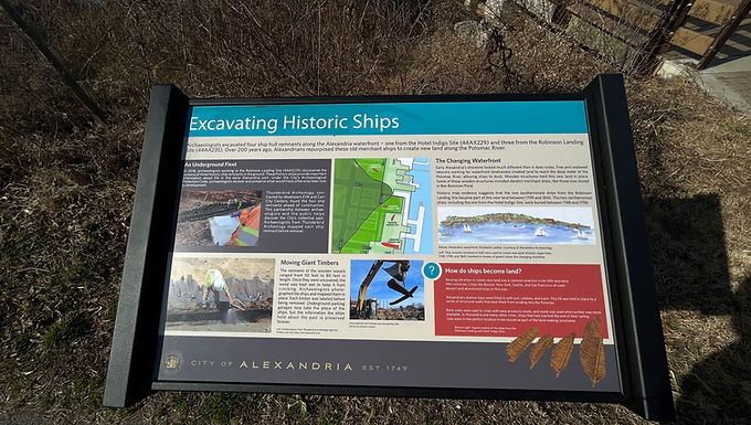
Excavating Historic Ships (Historical Marker)
GPS Coordinates: 38.8085612, -77.1133738
Closest Address: 4800 Brenman Park Drive, Alexandria, VA 22304

Here follows the inscription written on this roadside historical marker:
Excavating Historic Ships
City of Alexandria
— Est. 1749 —
Archaeologists excavated four ship hull remnants along the Alexandria waterfront — one from the Hotel Indigo Site (44AX229) and three from the Robinson Landing Site (44AX235). Over 200 years ago, Alexandrians repurposed these old merchant ships to create new land along the Potomac River.
An Underground Fleet:
In 2018, archaeologists working at the Robinson Landing Site (44AX235) discovered the remains of three historic ship remnants in the ground. These historic ships provide important information about life in the early Alexandria port. Under the City's Archaeological Protection Code, archaeologists recover and preserve what would have otherwise been lost to development.
Thunderbird Archeology, contracted by developers EYA and Carr City Centers, found the four ship remnants ahead of construction. This partnership between archaeologists and the public helps discover the City's collective past. Archaeologists from Thunderbird Archeology mapped each ship remnant before removal.
Moving Giant Timbers:
The remnants of the wooden vessels ranged from 50 feet to 80 feet in length. Once they were uncovered, the wood was kept wet to keep it from cracking. Archaeologists photographed the ships and mapped them in place. Each timber was labeled before being removed. Underground parking garages now take the place of the ships, but the information the ships hold about the past is preserved forever.
The Changing Waterfront:
Early Alexandria's shoreline looked much different than it does today. Free and enslaved laborers working for waterfront landowners created land to reach the deep water of the Potomac River, allowing ships to dock. Wooden structures held this new land in place. Some of these wooden structures included derelict merchant ships, like those now stored in Ben Brenman Pond.
Historic map evidence suggests that the two southernmost ships from the Robinson Landing Site became part of this new land between 1798 and 1845. The two northernmost ships, including the one from the Hotel Indigo Site, were buried between 1748 and 1798.
How do ships become land?
Reusing old ships to create new land was common practice in the 18th and early 19th centuries. Cities like Boston, New York, Seattle, and San Francisco all used derelict and abandoned ships in this way.
Alexandria's shallow bays were filled in with soil, cobbles, and trash. This fill was held in place by a series of structural walls that kept them from eroding into the Potomac.
Rock walls were used in cities with easy access to stone, and wood was used when lumber was available. In Alexandria and many other cities, ships that had reached the end of their sailing lives were in the perfect location to be reused as part of the land-making structures.
Marker Erected by City of Alexandria, Virginia.